From Science to Strategy: A Community Approach to Hydrology
Photo credit: Shreenivas Dharmaraja
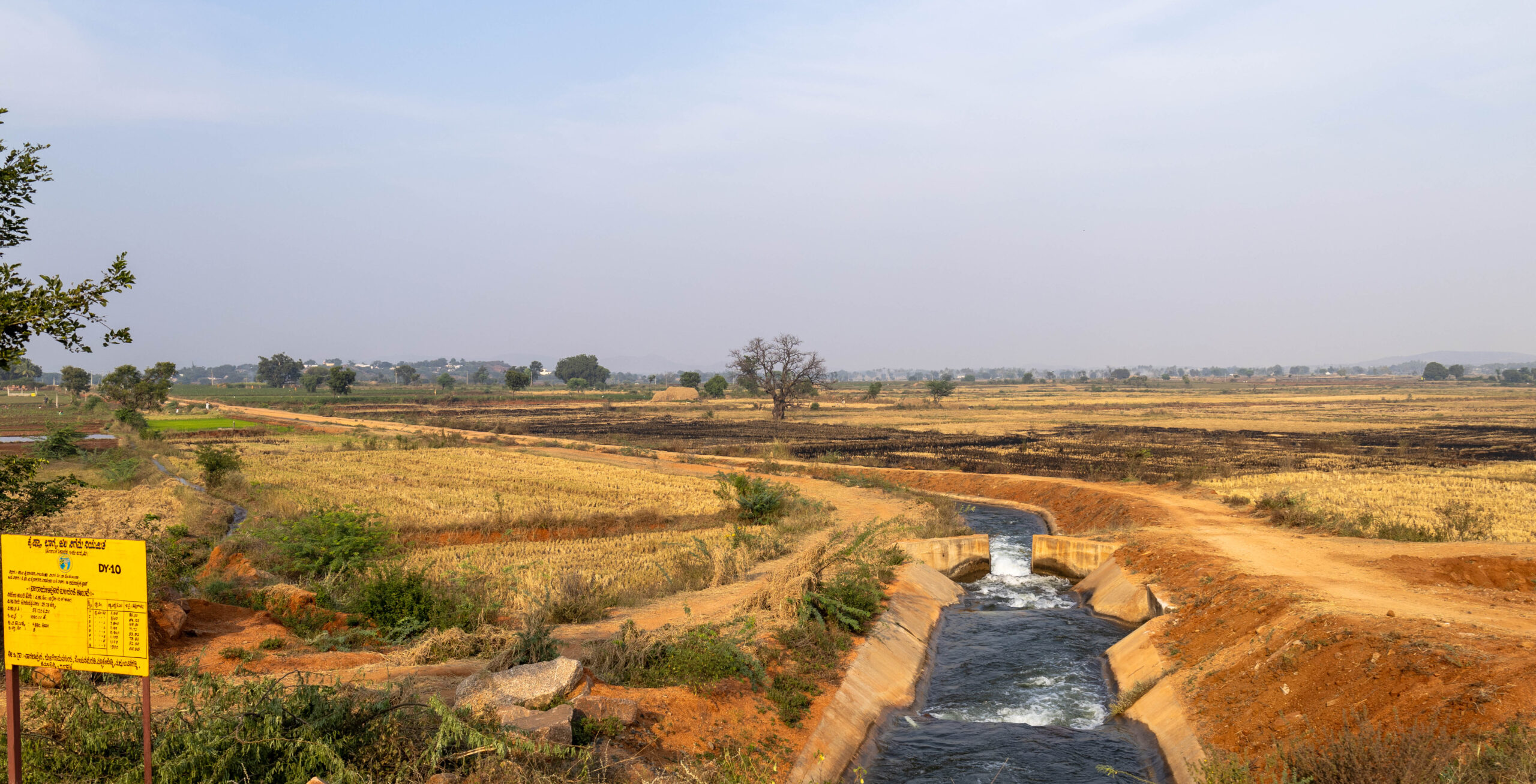
The way a farmer experiences and interacts with water in Karnataka’s Raichur district depends on where they live. A farmer near a water source, be it a river, canal, or field irrigation channel, can be stuck with too much water and with little control. A farmer away from such sources struggles with scarcity, while a farmer in dryland areas, with no access to canals, is entirely dependent on rainfall variability. This unequal distribution of water resources has a negative influence on all the stakeholders and on the regional water balance.
Over the past few months, WELL Labs has been working with local community members in Raichur to conduct a community hydrology programme. A set of four workshops spread across several months, the programme aims to engage local stakeholders to tackle complex challenges of rural water resilience.
The first two community hydrology workshops took participants through monitoring groundwater and surface water respectively. The third and most recent workshop taught them crop water budgeting and calculating the water balance of a landscape.
Community hydrology programme
Designed by the Futures Research team at WELL Labs, the programme aims to strengthen long-term capacity by equipping the local community to monitor surface and groundwater resources, rainfall, estimate crop water requirements, and make appropriate cropping decisions. Data and insights from the monitoring of water resources will contribute to more effective water governance through grassroots institutions like water user cooperative societies (WUCS).
It is designed to be a balance of theory sessions and practical field visits, and each workshop feeds into the next, which helps keep the participants engaged.
By engaging farmers in citizen science—where they regularly monitor groundwater levels, rainfall, and cropping patterns—it encourages collective action toward developing a regional water balance. This participatory, data-led approach empowers communities to make more informed decisions about water use. The programme also helps bridge the gap between academic hydrological research and its real-world application.
CLARITY
The community hydrology programme is part of CLimate Adaptation and Resilience In Tropical drYlands (CLARITY), a research project under the CLARE programme that aims to build equitable, sustainable, and climate-resilient development pathways in tropical drylands. CLARE is an initiative jointly designed, funded, and run by the UK’s Foreign, Commonwealth and Development Office and Canada’s International Development Research Centre (IDRC).
Reflections on the Third Community Hydrology Workshop
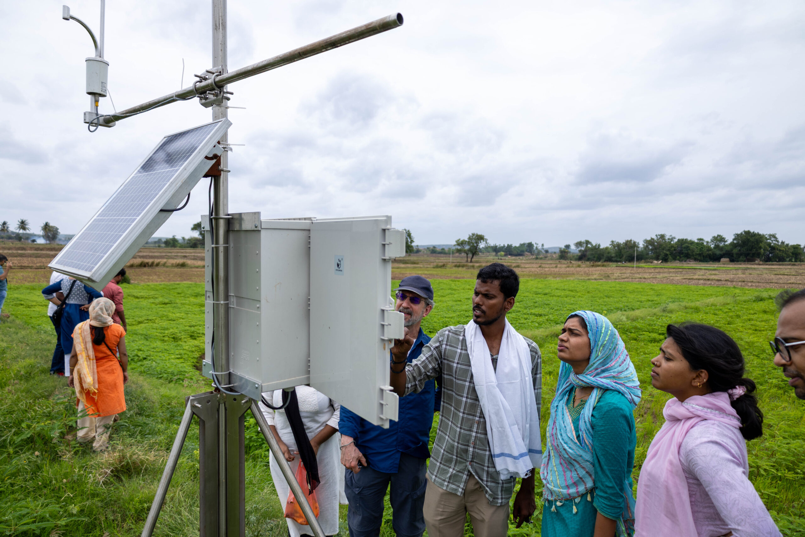
The third community hydrology workshop—held from May 20-22—brought together 31 participants from Devadurga taluk in Karnataka’s Raichur district. The diverse group included seven farmers from dryland areas, 13 from the head-end regions of the canal, four from the tail-end, three neerugantis (local water managers), and four members from Prarambha, a local civil society organisation.
The trainers from WELL Labs, Pandu Narayana and Arjuna Srinidhi, started the session by going over the first two workshops. In the first workshop, held in November last year, participants learnt how to measure the water depth in open wells and mapped over 800 dugwells and borewells across villages. In the second workshop, held in January, participants learnt how to monitor the inflow of water in canals, distributaries, and field irrigation channels. While the participants had understood how to measure water depth and speed, we wanted to focus on showing them what the accumulated data looks like at a landscape level. Our visualisations using a GIS interface and Excel-based graphs showed spatial and temporal trends in surface water and groundwater to help participants see the changes and connect them to differences in the weather and farming practices.
Read: Bridging Knowledge and Action: The Community Hydrology Approach

Community members attend the third community hydrology workshop in Devadurga, Raichur. Photo Credit: Shreenivas Dharmaraja
Over the three days, participants learnt about:
- The importance of a water balance exercise: Aside from receiving water from canals, farmers also extract water from dugwells and borewells to irrigate their fields, especially in rabi season. To better understand how surface water and groundwater are utilised, participants were encouraged to conduct a water balance exercise. Data from all three workshops will feed into these calculations.
- Installing and collecting data from a soil moisture sensor: As part of data collection for the water balance exercise, participants were taught about soil moisture, how to install the Acclima soil moisture sensor reader, and capture readings in KoboToolbox—an open-source platform that allows for easy collection, management, and analysis of data.
- Casing depth of borewells: To help the participants better understand the geomorphology of an aquifer, we showed them how to profile the ground when a borewell is dug.
- Crop water budgeting: Head-end farmers, with access to open field irrigation channels, tend to favour flood irrigation, leaving little water for the tail-end farmers. With better crop water budgeting, there can be more equitable distribution of water.
Participants are given an assignment at the end of each workshop, which they must complete by the next session. In the third workshop, they were divided into three groups to conduct a crop water budgeting exercise in their area. Those from head- and tail-end villages were divided based on their respective water user cooperative societies; the dryland farmers will work on crop water budgeting for their villages.
As the programme draws to a close, the participants will be equipped to read their own landscapes, anticipate water-related risks, and hopefully design context-specific solutions. The community hydrologists will work with water user cooperative societies to decide water use and crop choices.
If you are interested in conducting a community hydrologist workshop in your area, please contact Navitha (navitha.varsha@ifmr.ac.in).
Acknowledgements
This work was funded by UK aid from the UK government and by the International Development Research Centre, Ottawa, Canada as part of the Climate Adaptation and Resilience (CLARE) research programme. The views expressed herein do not necessarily represent those of the UK government, IDRC or its Board of Governors.
About CLARE
CLARE is a UK-Canada framework research programme on Climate Adaptation and Resilience, aiming to enable socially inclusive and sustainable action to build resilience to climate change and natural hazards. CLARE is an initiative jointly designed and run by the UK Foreign, Commonwealth and Development Office and Canada’s International Development Research Centre. CLARE is primarily funded by UK aid from the UK government, along with the International Development Research Centre, Canada.
About CLARITY
Climate Adaptation and Resilience in Tropical Drylands (CLARITY), a research project under CLARE, is building equitable, sustainable, and climate-resilient development pathways in tropical drylands. This Global South-led project will result in the creation of long-term assets (data and tools) and capacities to achieve transformational change.
Edited by Ananya Revanna
Follow us and stay updated about our work:
Related Posts
-
Co-Creating Solutions with Communities | Insights from the Futures Research Programme
The Futures Research team shares insights from their work on designing solutions for land and water challenges in the semi-arid Raichur and Chikkaballapur districts of Karnataka
-
Designing Climate Resilient Futures in Raichur
Raichur’s resilience to climate change is not built on a single path, but through the conscious navigation of multiple, co-existing hydro-social pathways. This makes the landscape of possibilities ...