WELL Labs Partners with IHE Delft, ACIWRM to Develop Community-Driven Data Solutions
WELL Labs has partnered with the IHE Delft Institute for Water Education, a research institute in the Netherlands, and the Karnataka government’s Advanced Centre for Integrated Water Resources Management (ACIWRM) to understand and improve community-driven applications of remote sensing data in India’s Krishna river basin. This partnership began in June 2023 and will continue until 2027.
The project is called RS-4C: Remote Sensing for basin-level community-driven applications and it is funded under the River Basins and Deltas theme of the Water and Development Partnership Programme (WDPP). Launched in 2008, the WDPP supports organisations in non-European, low- and middle-income countries as they strengthen their capacity to manage water in sustainable and inclusive ways. The third phase of the programme builds on the work done so far; IHE’s focus initially was to bring open-access remote sensing data and analysis to decision makers. The impetus now is to further develop this work in collaboration with country partners, and combine remote sensing applications with other data to support stakeholders at different scales. This is where our work comes in.
Our study focuses on the Krishna river basin.
As part of a larger international consortium that is exploring the use of technology to address water-related challenges in local communities, the India partnership led by WELL Labs and ACIWRM is centred around the Krishna river basin, in Karnataka state. It is one of the four case studies under this project. The others are the Athi river in Kenya, which is increasingly polluted and encroached upon; Lake Tana in Ethiopia, where the invasive water hyacinth is threatening local ecosystems and livelihoods; and the third spans Burkina Faso, Niger, Senegal, Mali and Ethiopia, where the focus is pastoral resource availability.
With a growing population and an increased demand for food production, water use has intensified in Krishna river basin, causing severe environmental pressure in this fifth largest basin in India. Even though new policies promote participatory approaches in combination with remote sensing data to address the challenges in the basin, there remains challenges – how do you implement this in practice and ensure that it leads to equitable outcomes for marginalised communities in this basin? These are pertinent questions considering the river basin falls over large swathes of semi-arid southern India, including drought-prone and impoverished districts such as Raichur.
Read | Restoring Landscapes and Improving Farmer Income, the People-Centric Way

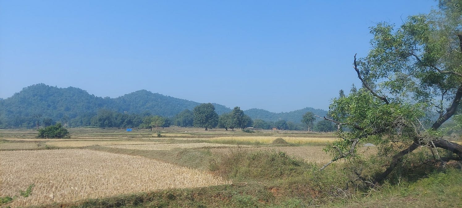
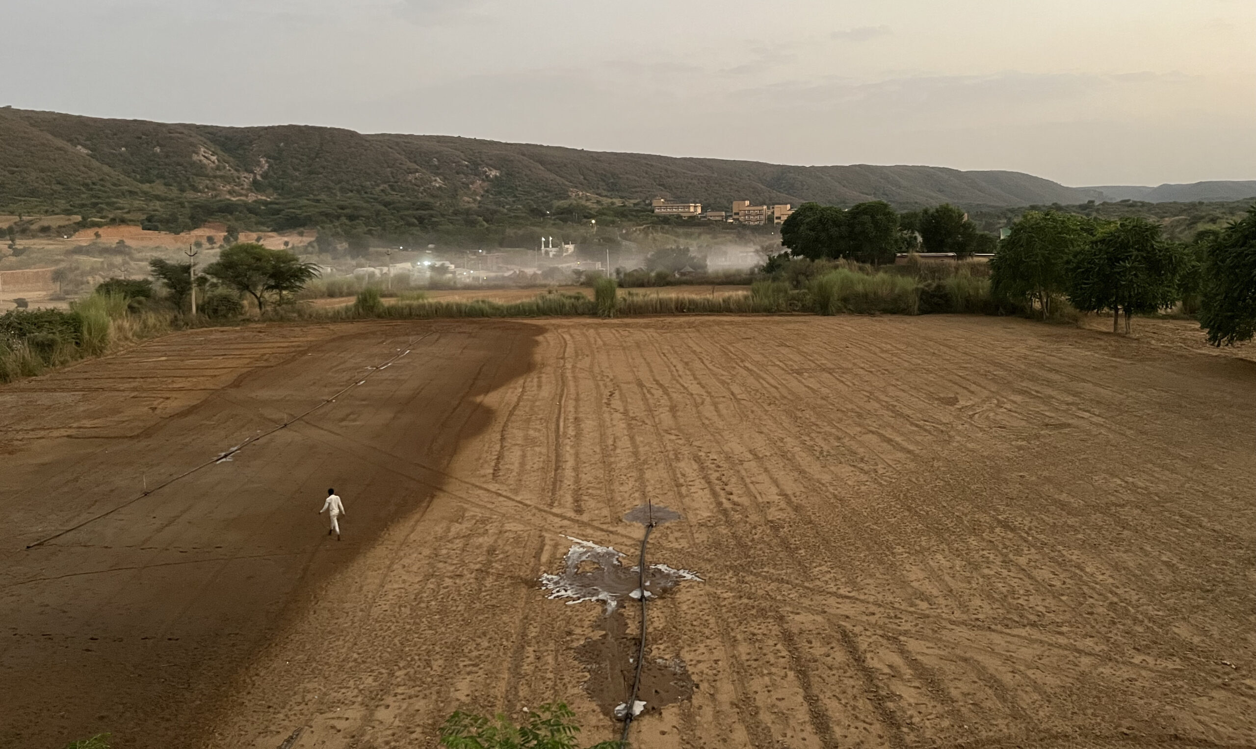
Trench cum bunds in drought-prone Raichur allows water to percolate into the ground and improve soil moisture. Credit: Manjunatha G.
It is critical to understand people’s concerns and capacities to improve uptake of data.
While Integrated Water Resources Management is crucial for addressing today’s water challenges, a lack of accessibility to good quality timely data is a bottleneck. Data that is collected is not always made available to all stakeholders, and often does not take into account the needs of already marginalised communities and vulnerable ecosystems.
The RS-4C project makes use of satellites to capture images and measurements remotely. Because of its inherent nature, remote sensing can address many of the challenges that impair data accessibility. This is a field that is advancing rapidly, however, we currently see that its applications for community-centred decision making is constrained by the lack of local capacities for interpretation of satellite data.
,Moreover, many remote sensing applications are also developed by researchers without an understanding of the needs of water managers and water users on the ground, and without adequate synthesis of their own modes of knowledge of water.
It is against this context that the RS-4C project identified three main objectives:
- Co-develop community-driven data-based solutions
- Explore approaches and mechanisms to better combine remote sensing data with local knowledge and in-situ data
- Improve mechanisms through which this combined data can be made available to communities and other stakeholders, for them to use in their efforts for better water management.
The co-development of these solutions will be iterative and a joint learning process. The questions of who will use the solution, for which purpose(s) and what planned outcomes will therefore be central in the project process. These aspects will be continuously monitored and discussed.
Once new data tools are developed, the next challenge is how these can be adopted and used to bring about socially-just and ecologically-sustainable outcomes – a core tenet of WELL Labs’ mission as well as the WDPP’s.
With the assumption that lack of capacity is one bottleneck, this project will work to train researchers and water professionals to improve their capacity for working with remote sensing data. The partners will also work together and study other bottlenecks for adoption of data tools as well as analyse success stories from other projects and literature.
This project will feed into the work we are already doing in Raichur.
As mentioned above, Raichur is one of the districts that falls under the Krishna river basin. Situated in north Karnataka, this region is hot and dry, and the livelihoods here are derived mainly from farming. But land degradation and falling wages is fuelling economic distress and forcing people to migrate, as we have learnt from our research here under the Rural Futures initiative.
Read | Feeding Humans has Trapped the World in Debt, Degradation: FAO Report Explained
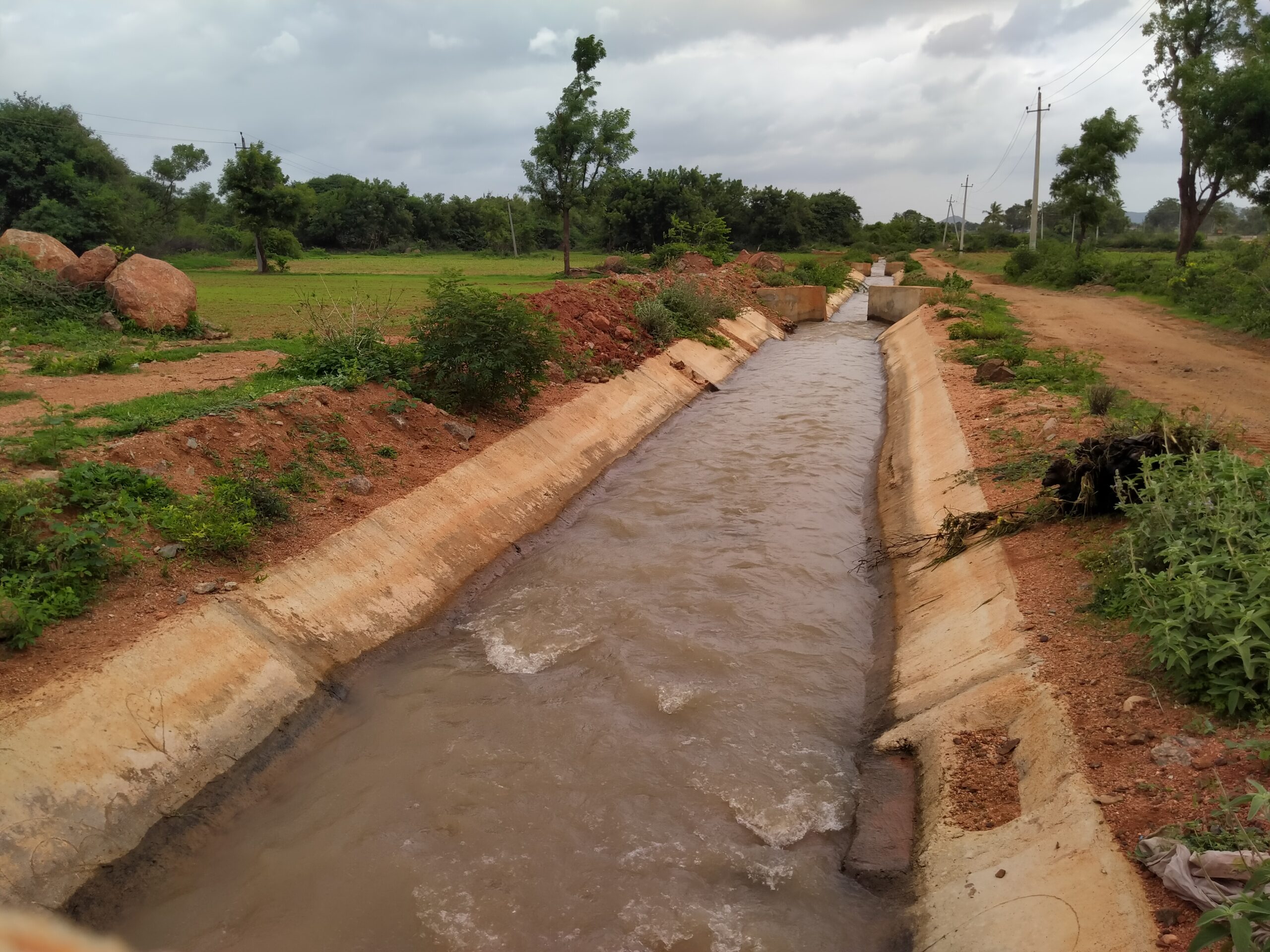
In terms of water management, Raichur district can be classified into distinct regions – the canal-fed irrigated areas, where excessive irrigation has led to depleting soil fertility, and the rainfed areas, where there isn’t access to enough water to grow a second crop. Critical to our fieldwork here is our partner, Prarambha, a local NGO that has been carrying out rural development work in north Karnataka for the last few decades. For this project too, we will directly engage with them in the region downstream of the Krishna basin.
To begin with, using remote sensing-based, high resolution agricultural Land Use Land Cover (LULC) maps, WELL Labs and ACIWRM aim to calculate water accounts for all villages in the district that will assist in local participatory planning for water resources. Please follow our newsletter and social media to stay updated about our work under this project.
Cover photo by Manjunatha G.
Edited by Kaavya Kumar
If you would like to collaborate, write to us. We would love to hear from you.
Follow us and stay updated about our work:
Related Posts
Related Posts
-
Field Notes from Jharkhand: Testing Jaltol on The Ground With WASSAN
By collating secondary data and allowing for grassroots communities to input specific primary data, Jaltol can address the data and technical gap that impairs water budgeting and rural water planning.
-
Drinking Water for Every Rural Household: A Tamil Nadu Village Highlights Challenges
We visited Nadiyam, a coastal village in Tamil Nadu, to examine water supply under the Jal Jeevan Mission and the challenges in sustaining piped drinking water access in rural areas
-
Rural Water Security: How Our Vision for Jaltol Has Progressed
WELL Labs is co-developing with its partners simple user-friendly tools, under the Jaltol framework, to help us diagnose the magnitude of water mismanagement and track our progress towards water se...
-
How Often are India’s Farming Patterns Changing? With IIT Delhi, We Turn to New Land Use Maps for Answers
Remote sensing data validated through reports from the ground can capture changes in spatial agricultural patterns down to plot level. This blog sheds light on land use maps developed by IIT Delhi ...
-
Remote Sensing in Rajasthan: Can Jaltol Buttress Traditional Johads?
We team up with Tarun Bharat Sangh to see how remote sensing can aid planning, impact evaluation and scaling up for johads, the traditional earthen embankments that are key to water conservation ef...
-
WELL Labs Partners with IHE Delft, ACIWRM to Develop Community-Driven Data Solutions
WELL Labs has partnered with ACIWRM and IHE Delft to understand and improve community-driven applications of remote sensing data in India’s Krishna river basin.